Vaca Muerta Atlas · by upstrm.ai

All of Vaca Muerta on one map.

Every public well, production and activity record from Argentina's Secretaría de Energía, in one clear map you can explore and share with a link. Updated monthly. No expertise needed.

atlas.upstrm.ai
Vaca Muerta Atlas map of the whole basin: wells, blocks, fluid windows, rivers and towns
Public dataArgentina's Secretaría de Energía well and production registry
Updated monthlyProduction data through August 2026
Straight from the sourceOfficial registry data you can check, not numbers copied from presentations
EN / ESImperial or metric: ft/bbl or m/m³

What's inside

Answers to the questions everyone asks about Vaca Muerta.

Whether you invest in it, supply it, finance it, report on it, regulate it or study it, skip the spreadsheets and company presentations. Click a well and get the answer.

01

Who's drilling where, and how much?

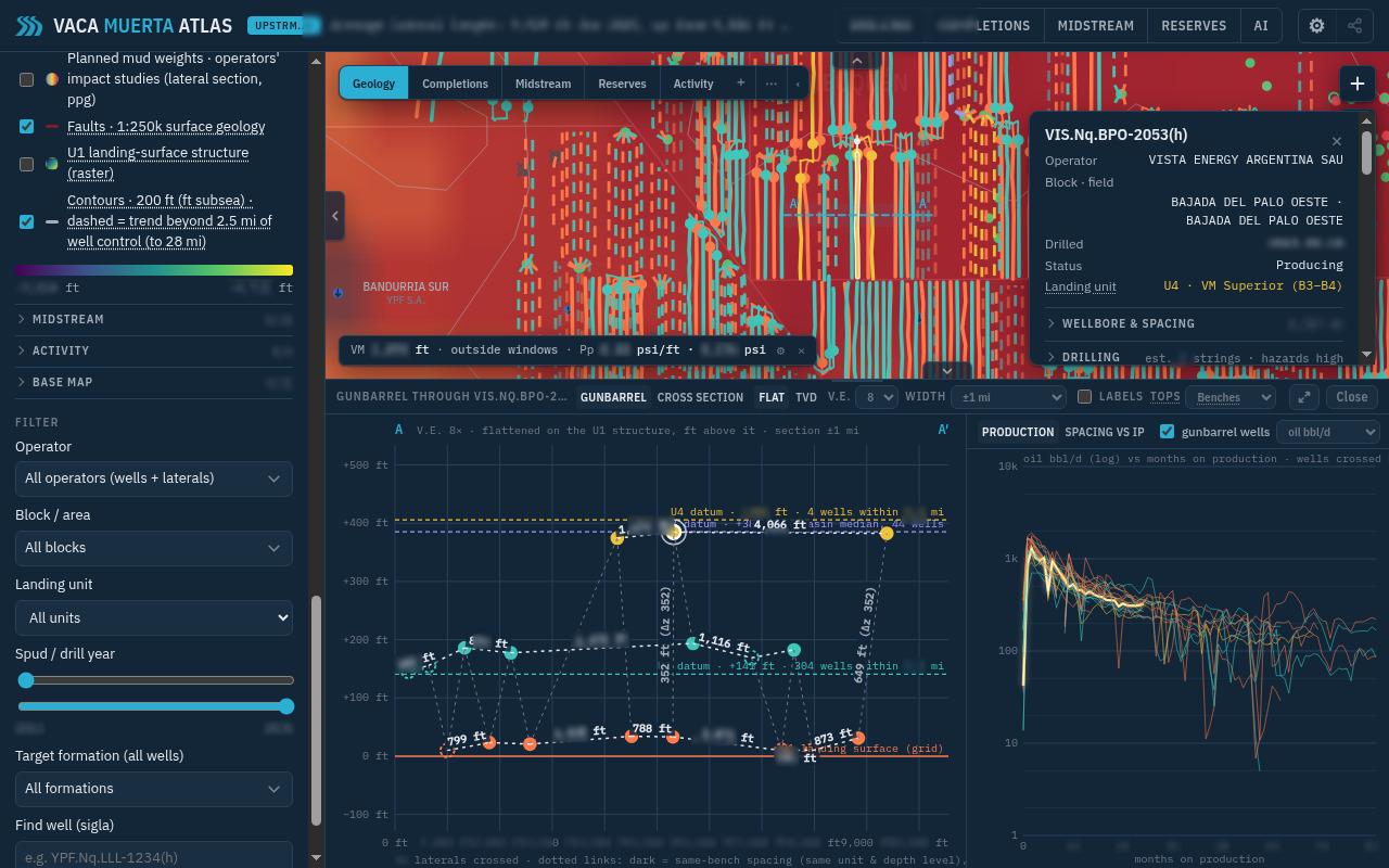
See every well by operator, block, drill date and status, together with its production history. Filter by company, block or year, and color the map by more than 20 attributes to spot the trends that matter to you.

  • Operator
  • Block
  • Drill year
  • Status
  • Production
  • 20+ attributes
Gunbarrel through a pad with a well card open and its oil production history
Gunbarrel through a pad, with a well card and its production history.
02

See flaring from space, pad activity, and the pipeline network.

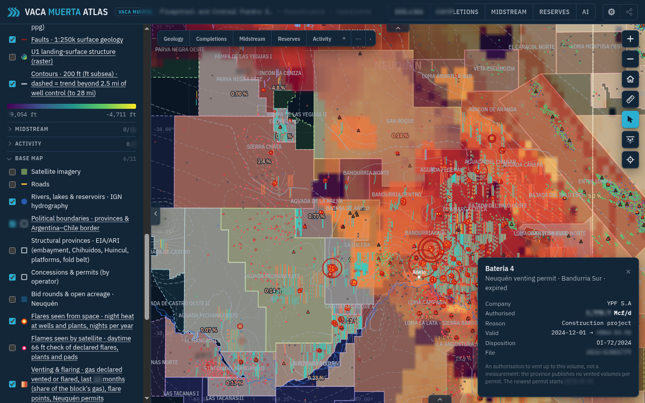
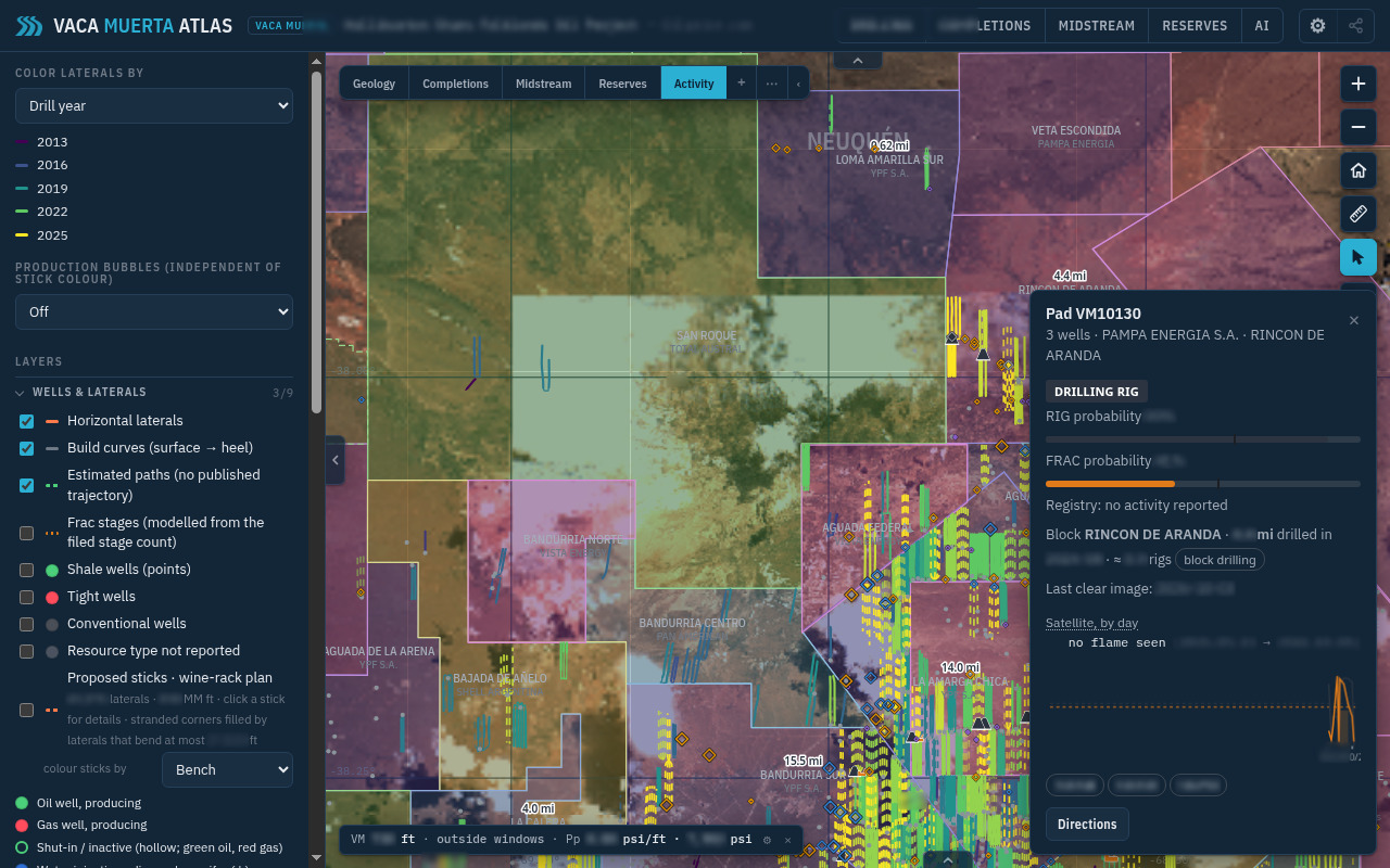
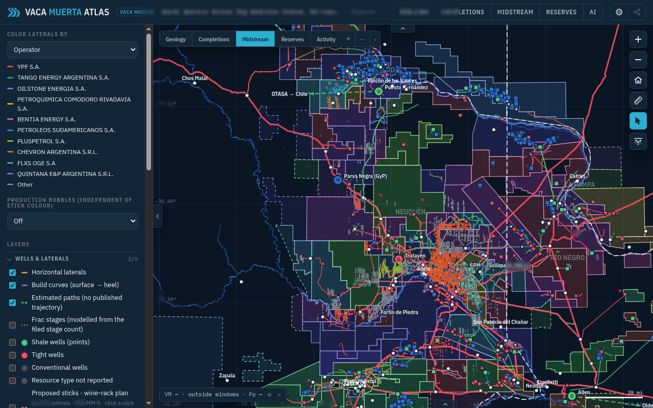
Night flares and declared venting show up on the map around Añelo and across the basin. Satellite picks up pad activity with rig and frac probability. The midstream map lays pipelines, plants, water and disposal over laterals by operator.

Flaring, venting and satellite activity come from public declarations and imagery overlays. Screenshots are illustrative.

Night flares from space and venting and flaring around Añelo
Night flares from space and venting around Añelo.
03

For technical teams

Frac stages along laterals, and the well card.

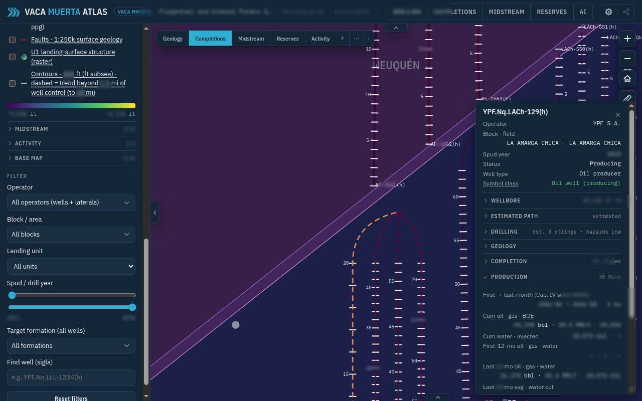
See modelled frac stages along laterals, open any well card for completion and production detail, and color the map by landing unit (U1 to U5, the layer of Vaca Muerta it's drilled in). Gunbarrel and spacing views are there when you need them, all on public registry data.

Modelled frac stages along laterals with a well card open
Modelled frac stages along laterals, with a well card open.

Pricing

Simple pricing. The whole basin.

Monthly US$99 per month
Yearly US$999 per year

Teams: yearly, the same US$999 per seat, with a 5-seat minimum (from US$4,995/year). Every team seat includes the MCP connector and deep AI answers.

Pay by card in US dollars. In Argentina, you can also pay in pesos with Mercado Pago.

  • Every well on one map: activity, production, operators, midstream and geology
  • Emissions, satellite pad activity, and the midstream pipeline map
  • Technical views: gunbarrel, frac stages, spacing and productivity charts
  • Link sharing · EN/ES · imperial or metric · AI assistant
Open the Atlas

Got a shared link? Open it to see the view they shared.

About upstrm.ai

Less searching. More knowing.

Anyone following Vaca Muerta should be able to see what's happening in the basin without piecing together spreadsheets and slide decks. upstrm.ai builds AI tools that make oil and gas data easy to use, starting with Vaca Muerta Atlas.

Investors and analysts, service and midstream companies, banks, consultants, journalists, government, students, engineers and geologists: if Vaca Muerta matters to your work, the Atlas is built for you.

See the basin the way it actually is.

Open the Atlas

Contact

Email is good but WhatsApp is better!

Send us a message for anything from support to sales.